


A planning proposal in Ingleside to rezone rural land for 536 new dwellings has prompted community concern about bushfire evacuation, road capacity, and infrastructure limits in the area.
Background and Context in Ingleside
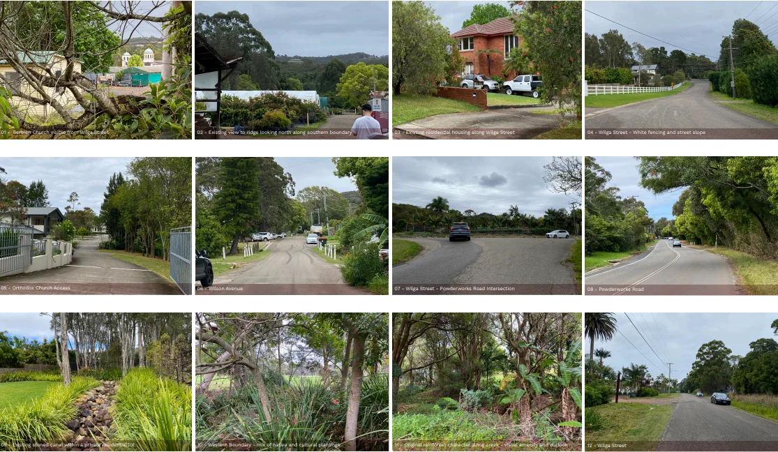
The proposal covers 28.8 hectares, with the proponents holding 14.248 hectares. The land currently includes rural and horticultural uses, St Sava Church on Wilson Avenue, and seniors housing on the south-western edge. Earlier precinct planning between 2016 and 2022 was discontinued due to unresolved bushfire evacuation risks.

Details of the Proposal
The proponents seek to shift zoning from RU2 Rural Landscape to R3 Medium Density Residential, alongside RE1 Public Recreation and C2 Environmental Conservation areas. The proposal outlines 536 dwellings in the form of detached homes, terraces, manor houses, and apartments. Indicative building heights range from 8.5 metres to 24 metres.
The application includes amendments to minimum lot sizes, a potential urban release area designation, and biodiversity corridor refinements. A site-specific Development Control Plan would follow if the proposal proceeds. Conservation zones are planned along Mullet Creek, which crosses the site from west to east.
A rezoning request submitted on 5 August 2025 seeks changes to the Pittwater Local Environment Plan 2014 for land in the Wilga Wilson Precinct. Public exhibition began on 10 September 2025, closing on 1 December 2025. A separate community petition encouraged residents to lodge submissions before 30 November.

Bushfire and Evacuation Considerations in Ingleside
A strategic bushfire study stated that the proposal meets current guidelines. An accompanying Rural Fire Service letter noted that Powderworks Road and Mona Vale Road remain limited evacuation routes because sections pass through bushland. Planned internal roads do not create additional external escape links.
Residents referenced the 1994 bushfire, when several homes were lost and the Maclean Street reservoir ran dry. Concerns raised relate to reliance on a single evacuation route, the area’s bushfire exposure, proximity to national parks, and vegetation growth following recent wet conditions.
Traffic, Transport and Infrastructure
Traffic modelling considered outbound movement on Powderworks Road during emergencies. Residents remain concerned about peak-hour congestion and the distance from major transport connections. Community submissions also referenced pressure on utilities and local amenity.
Community Response
Residents have expressed support for housing growth but prefer an R2 low-density zoning consistent with surrounding areas such as Narrabeen. A petition has gathered more than 1,000 signatures, raising issues related to evacuation, traffic, and the effect on the area’s semi-rural character.
Online discussions reflect varied views, with many focusing on safety, accessibility, and environmental constraints.
Previous Planning Attempts
A 2016 draft Ingleside plan proposed 3,400 dwellings but was discontinued following evacuation risk assessment. A later proposal in 2021 outlined 980 lots south of Mona Vale Road and was set aside in 2022 due to unresolved bushfire modelling, infrastructure feasibility, and biodiversity impacts.
Next Steps
The application, listed as PEX2025/0001, will be assessed against statutory planning requirements and the submissions received. Further stages of review and consultation will occur as the process continues.
Published 7-Dec-2025


