


Northern Beaches has a purpose-built fauna bridge meant to help native animals cross safely, but local residents and wildlife advocates say the structure, found in Ingleside, could lose much of its value if the bushland at its ends is not protected as a usable corridor.
The concern follows the opening of the Mona Vale Road East upgrade in March 2024, which included two fauna crossings, a bridge and an underpass. These crossings link to a wider wildlife corridor between bushland near Ingleside and reserves and national park habitat to the north.
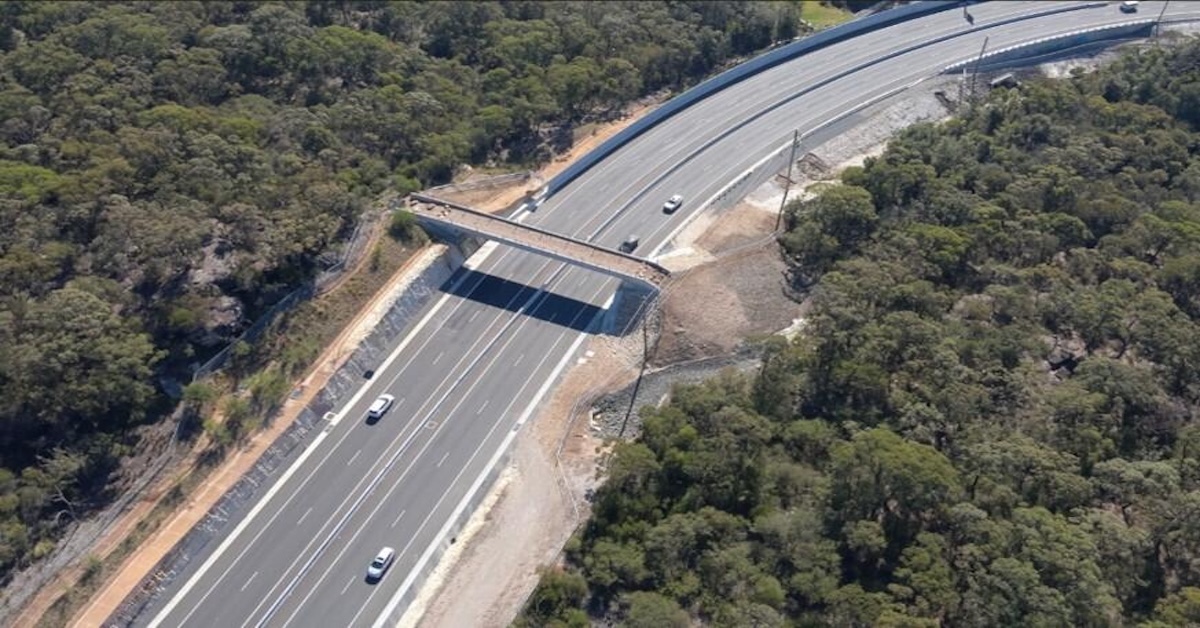
The fauna bridge sits along Mona Vale Road East near Ingleside. The project contractor describes the structure as a wildlife overpass designed to help animals move between habitats and reports that bandicoots and wallabies have been recorded using it. It has been pegged as Greater Sydney’s first fauna bridge.
What The Planning Strategy Says About Corridors
The draft land use and infrastructure strategy for Ingleside describes how roads and development can fragment habitat, and it outlines the role of fauna corridors and crossings in keeping bushland connected. In a section on proposed Mona Vale Road fauna crossings, it notes upgrades intended to improve fauna connectivity across Mona Vale Road East and links this to the broader corridor network through the Ingleside precinct.
That matters because the corridor concept depends on conditions outside the bridge itself. The same strategy explains that connectivity depends on aligning crossings with corridors throughout the precinct, rather than simply building structures over or under the road.
Why The Link Could Break Down
Community voices raising the alarm say the problem is not the engineering, but what surrounds it. The key point in both local reports is that if land near the ends of the crossings is developed or fenced in a way that blocks movement, animals may cross the road and then be stopped by backyard fencing and other barriers. There are calls for stronger protection of nearby land so the crossing connects to real habitat rather than dead ends.
Northern Beaches Council’s conservation zones review explains how environmental zoning is being reviewed and how evidence is used to inform where conservation controls should apply. While the council does not determine state planning outcomes on its own, its published material indicates that conservation zoning is part of the wider planning work underway across the area.
Supporters of corridor protection say the issue is more than a single structure because many native animals rely on connected vegetation to find food, mates and shelter. The eastern pygmy-possum is listed as a vulnerable species in NSW under the NSW threatened species process, which is one reason conservation groups often point to habitat protection and connectivity as practical issues in local planning debates.
The Next Steps
The next steps hinge on planning controls and how land near the crossings is treated as zoning work continues. Council information on the conservation zones review sets out how environmental zones are being assessed and discussed with the community.
Residents and local groups backing corridor protection say their main goal is simple: keep the bushland link in place so the crossings continue to connect habitat on both sides, rather than becoming an isolated feature beside a major road.
Published 6-Feb-2026

