


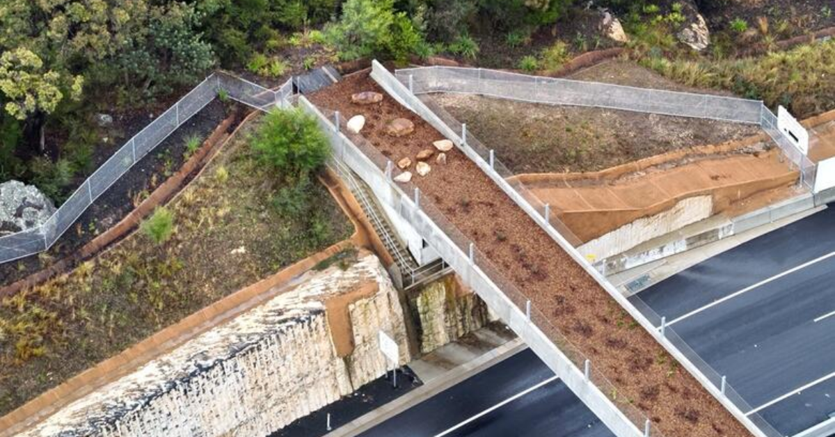
The Ingleside wildlife corridor near Mona Vale Road could receive stronger environmental protection under a proposal to conserve State-owned bushland and maintain habitat connections for native animals.
NBC has agreed to investigate the possible transfer of identified land parcels from the NSW Office of Strategic Lands, alongside proposed changes to environmental zoning. The land forms part of a wildlife corridor connecting Ku-ring-gai Chase National Park, Katandra Bushland Sanctuary and Ingleside Chase Reserve, with further habitat links to Irrawong Reserve and Warriewood Wetlands.
Conservation Zoning Considered for Ingleside Bushland
The proposal involves applying C2 Environmental Conservation zoning to identified parcels currently proposed for C3 Environmental Management zoning. The proposed C2 arrangements would provide greater protection by prohibiting dwelling houses and other land uses that could affect the area’s environmental values.
A preliminary environmental assessment found that much of the bushland remains largely intact and in good condition. The Ingleside corridor contains habitat that supports, or has the potential to support, more than 30 locally threatened species. Its native vegetation also includes coastal upland swamp, an endangered ecological community. The surrounding bushland provides connections between natural areas across Ingleside and towards neighbouring Elanora Heights.
Wildlife Crossings Rely on Connected Habitat
The protection proposal also concerns bushland surrounding the existing fauna overpass and underpasses along Mona Vale Road East. The crossings were constructed to provide safer passage for native animals moving between habitats separated by the road.
Maintaining vegetation on either side of these crossings is considered important to their long-term function as part of the wider wildlife corridor. Pittwater Natural Heritage Association has campaigned for the protection of this bushland for several years.
Association members Jacqui Marlow and David Palmer raised concerns about potential residential development near the fauna crossings and the importance of retaining connected native vegetation. Their submissions also identified the role of the corridor in allowing wildlife populations to move between reserves rather than becoming isolated in smaller areas of bushland.
Further Environmental and Land Assessments Planned
Before any transfer proceeds, investigations will examine the condition of the identified land, financial and management responsibilities, bushfire obligations, potential contamination and geotechnical risks. Possible future management activities include bushland regeneration, weed control and hazard reduction.
If the transfer proceeds, the land is intended to be classified as Community Land under the Natural Area – Bushland category, retaining it for conservation and sustainable community use. A further report will be required before any land transfer is finalised. The proposed zoning and transfer remain subject to additional investigations and decisions.
Published 30-October-2026